Kite Aerial Photography (KAP)
Description
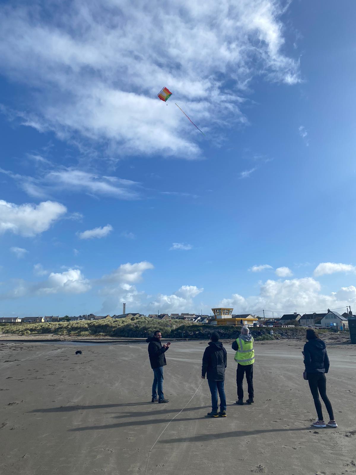
For high resolution topographic data to monitor dune/cliff erosion, normally expensive instruments like terrestrial laser scanner is used. Lower cost alternatives to theses are drones and kites. As drones have flying restrictions, it makes the kites a truly low-cost alternative for engaging citizens for the regular topographic monitoring of the beach-dune system. Ideally an action camera like Go pro is fitted onto a special type of mount called the picavet mount which is released onto the kite lines. As the kite is flown higher, at a particular height it starts to fly stably and the preprogrammed gopro starts to collect aerial images. These aerial images are later subjected to a SfM vision algorithm in suitable software to extract point clouds and form a Digital Surface Model. Such DSMs collected at a regular interval (say 3-6 months) are substracted from one another to quantify any morphological change.
Monitored Parameters:
Hazards:
✓ Relevant to WP3 models ✓ Relevant to the EWSS
€250.00
Minimum Quantity : 1
| Accuracy (error of the measurements) | Unit of measurement | Data Refresh Time (mins) | Wi-Fi Connection | 4G Connection | External Power Supply | Documentation |
|---|---|---|---|---|---|---|
| 27.9mm | mm | 1 | False | False | False | See available docs for Kite Aerial Photography (KAP) |
| Reference Partners | Project Name | Project Year | Reference Paper | Minimum Purchase | Spatial Density |
|---|---|---|---|---|---|
| ATU | Tracking Fine-Scale Structural Changes in Coastal Dune Morphology Using Kite Aerial Photography and Uncertainty-Assessed Structure-from-Motion Photogrammetry | 2018 | Reference paper | 1 | 1 |
| Purchase operations complexity | Assembly/Calibration Operations Complexity | Deployment operation Complexity | Deployment Cost | Data Analysis Operations Complexity |
|---|---|---|---|---|

| 
| 
| 
| 
|
| Citizen Science Activities Complexity | Assembly Public Involvement | Deployment Public Involvement | Data analysis Public Involvement | Target Users |
|---|---|---|---|---|
| Easy | High- Stakeholders can be easily involved to assemble the kite components. The only relatively difficult part is the assembling of the camera mount. But these mounts will be 3D printed and tutorials on how to fit the camera onto the mount will be provided. | High- The kite can be easily deployed in a windy setting like the beach. The kite generates pull so needs to be managed by at least two people . Gloves need to be worn to avoid friction with the kite line. | Limited-The video images generated via the GoPro camera can be easily downloaded and archived. Though these aerial images are useful in itself (to understand qualitatively the erosion/flooding etc), the most challenging part is to process these images to get outputs like digital elevation models (DEM; to quantify the amount of sediment lost) which requires expert intervention. | local groups; local authorities; schools |